SCIENTIFIC STAFF:
Carla Barnaba,
Alessandro Vuan
RESPONSIBLE SCIENTIST: Alessandro Vuan
Centro Ricerche Sismologiche, Istituto Nazionale di Oceanografia e Geofisica Sperimentale, Cussignacco (UD) e Sgonico (TS)
The temporary seismometric network of Tolmezzo and Cavazzo Carnico is one of the activities performed within SISMOVALP Project, within the framework of the EU INTERREG IIIB "Alpine Space" Program. This project developed in the period 2003-2007 with the aim of improving the knowledge of the seismic hazard and vulnerability of the alpine valleys, thus providing indications for reducing the overall seismic risk.
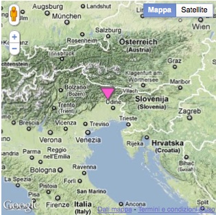
The study area investigated by OGS has been the Upper Tagliamento River Valley (Fig. 1). This area includes the town of Tolmezzo and Cavazzo Carnico (s.l.m. 270-340 m) and is located close to the hypocenter of the 1976 M=6.4 Friuli earthquake and is characterized by medium strong earthquakes mainly due to blind thrust faults extending from East to West. The valley has an alluvial (U) shape with a maximum width of about 2200m and the thickness of quaternary deposits is greater than 200 m. The Upper Tagliamento River Valley is the result of numerous glaciation processes and erosive processes alternatively due to glacial and fluvial actions. Today, most of the valley on the right part of the river is characterized by alluvial terraces, several tens of meters high. The whole valley is underlain by unconsolidated alluvial material of quaternary age.

With the aim of estimating the seismic response of the valley through earthquake records, 6 seismic stations were deployed across the valley along a transect from Cavazzo Carnico to Amaro municipalities in a first phase of the activity. One of the station was used as a reference site. The acquisition developed for 16 months in the period June 2004 - September 2005.

545 events were recorded, included the Kobarid M=5.1 event of 12 july 2004. Around 60 events were used to estimate the spectral ratios to a reference station across the valley. Largest velocity amplification was found for the stations deployed in the center of the valley while at higher frequencies the strongest amplification was found at the edges. A polarization analysis on the raw record showed that at the edges the ground motion is polarised mainly along the horizontal plane while at the reference station on the right and the other stations did not show a preferential polarization.
