SCIENTIFIC STAFF:
Enrico Priolo1,
Roberto De Franco2,
Carla Barnaba1,
Giovanna Laurenzano1,
Marco Romanelli1,
Grazia Caielli2,
Adelmo Corsi2,
Alberto Tento2,
Graziano Boniolo2,
Andrea Morrone2,
Paola Ragazzo2
RESPONSIBLE SCIENTIST: Enrico Priolo1
1Centro Ricerche Sismologiche, Istituto Nazionale di Oceanografia e Geofisica Sperimentale, Cussignacco (UD) e Sgonico (TS)
2Istituto per le Dinamiche dei Processi Ambientali, Consiglio Nazionale delle Ricerche, Milano
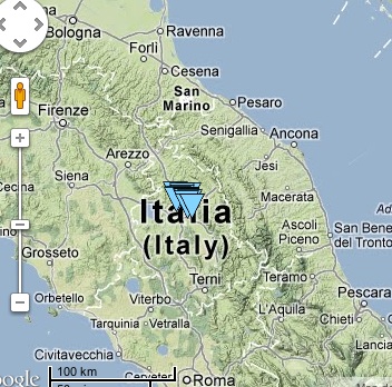
In 2012, OGS was charged by the Umbertide Municipality (Comune di Perugia) with the task of performing a geophysical study
in view of the microzonation of the city. This study encompassed the registration of earthquakes through a temporary
seismic network and the acquisition of environmental seismic noise.
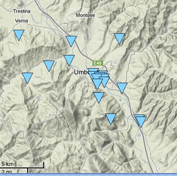
The temporary network of Umbertide was implemented in two successive phases using 10 seismological stations in synchronous acquisition, respectively. The recording equipment consisted of Reftek 130 stations with three-component 1 Hz sensors (Lennartz 3-DLite/1 s). A total of 20 sites, including four reference sites, was monitored (Fig. 1). Sites were chosen within or close to public or historical buildings (e.g. schools, hospitals, churches, ancient buildings, ...), according to the italian regulations and the indications provided by the Umbria Region (Table 1).
The temporary network ---whose sites and data have been include into the OASIS database--- was deployed in March 2012 and will remain effective till December 2012. Among other regional earthquakes, the network recorded the Ferrara Earthquake Sequence of 20.5.2012 and 29.5.2012.